Navigate the heat in the city.
Find the coolest route to your destination.
Be aware of the temperature around you.
LLcloud’s urban heat navigation solution helps citizens find the coolest pedestrian routes in their city and navigate the heat on their daily commutes. To do so, It integrates multi-sensor urban heatmaps from satellite and other data with smart city open data, and wearable hyperlocal temperature measurements.


Heat in the City
For too long the world has been in a WAIT state when it comes to climate change and Earth temperatures rising. The new urban heat navigation solution by LLcloud is based on the novel conceptual design of WATI (Wearable Ambient Temperature Indicator) by Iana Nikolova, our UI/UX and wearable product designer. WATI is designed to address the urgent need for localised heat awareness in the face of intensifying urban heat islands, more frequent and prolonged heat waves, and climate change. Existing weather apps lack ground-level temperature precision, and fitness wearables and mobile devices do not track ambient environmental temperature.
The LLcloud platform powers the next generation of wearables and apps using satellite, smart city and hyperlocal data, with WATI being the first of this kind.
Urban Heat Navigation
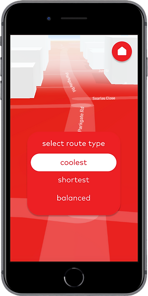
Our technology and solution for urban heat navigation have been implemented into a WATI mobile app prototype (see below) for tests and use by clients and partners. This mobile app integrates multi-sensor urban heatmaps from our partner meteoblue with smart city open data, and wearable hyperlocal temperature measurements, to recommend coolest routes in the city.
The WATI wearable and mobile app, and the urban heat navigation solution have been showcased at many major expos and conferences, including the Royal College of Art in London in July 2025, the CASSINI Entrepreneurship Days 2025 in Prague and Slush 2025 in Helsinki.. You can see them in action in the video further below.

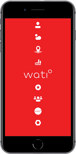
Urban Heat Navigation Mobile App


LLcloud's Multi-Sensor Urban Heat Navigation Main Features & Benefits
-
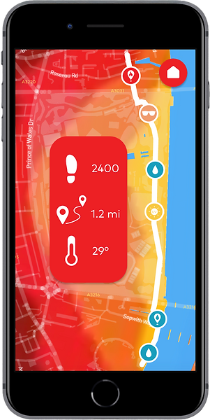
Calculates and recommends the coolest pedestrian routes between point A (your current location) and point B (your destination) in the city.
-
Navigates you along the selected cooler route using an simple and intuitive UI.
-
When recommending cool routes, takes into account places along it with water fountains, green spaces, ventilated and shaded places, if such open data is available for your city.
-
Uses EO satellite thermal data for large-scale mapping, combined with ground-based data to create hyper-local thermal measuring precision and mapping.
-
The complementary WATI wearable, measures hyper-localised outdoor temperature and displays in on a cool circular interactive display to inform the wearer and others around.
-
Provides real-time alerts and advanced analytics which prompt real-time responses.
-
The WATI wearable contributes to very accurate crowd-sourced heatmaps that aid urban city authorities and planners.
-
This urban heat navigation solution has been built entirely with LLcloud's multi-sensor platform, so we can further customise it to meet your specific needs and requirements.
Pricing
If you are a citizen trying to navigate the rising heat in your city, a company having outdoor staff working in extreme conditions, or a city authority that needs to measure and monitor urban temperatures, please contact us describing your needs.